


Return to Wilderness
William Jaeger
April 15, 2020 – May 11, 2021
The Erie Canal
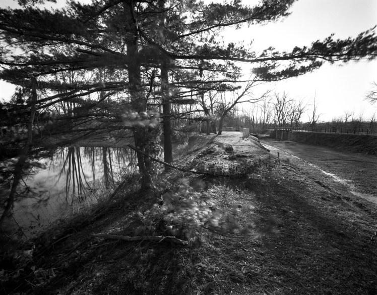
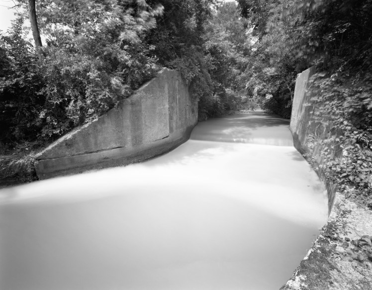
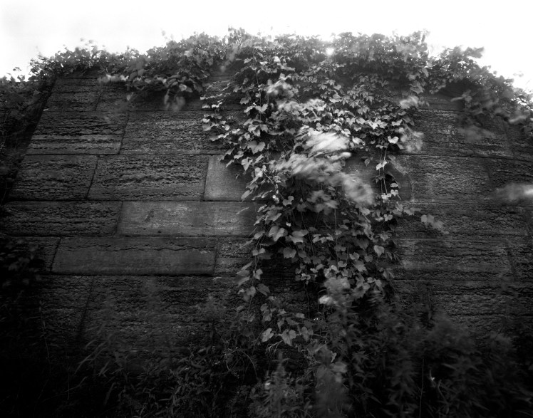
Finding the true, original, legendary Erie Canal—even just pale vestiges of it—can be confounding. The first Canal was built, mostly, between 1817 and 1825, well before photography was born and could solidify what it looked like. It was such a huge success for the industry of New York State, the “ditch” was radically improved just twenty years later, often wiping out most of the original dig with new excavation. This second version is what most people stumble on these days biking or reading historic markers between Albany and Buffalo.
In another twist, what we loosely call “the Erie Canal” still exists and was renamed the Barge Canal, a further rerouting and improvement from the early 20th Century. From Albany westward toward Syracuse, this new route is largely an adaptation of the Mohawk River. This time, much of the second 1840s canal was abandoned to fester and regenerate as scrub land, a long strip of once and future wilderness either owned or controlled by New York State. It’s been over a hundred years since the first and second canals have been abandoned, and this is the mysterious ribbon of land the photographer explored in the regions around Albany and Schenectady.
It’s much like finding an abandoned railroad track, cutting through bland and neglected woods, brushing against some new condominiums, disappearing now and then for a road or a shopping center. But the Canal presents an even earlier history (railroading only got up its steam, we might say, in the mid-1800s). And the Canal depended on water, which to this day pools and stagnates and sometimes hints at what once was. In 2020, many parts of the route have been transformed into parks and bikeways, and there is growing appreciation for the Canal in its reimagined state.
The Pine Bush
The Pine Bush is an ungainly, forbidding, and oddly enchanting quirk of recent geologic history. When the glaciers receded some 10,000 years ago, a few areas between Albany and Schenectady were filled with huge depths of sand. That meant a quirk of ecology, with specialized “pine barren” ecosystems that could tolerate the harsh soils—and so prairie grasses, wild lupines, and hardy trees like pitch pine and scrub oak took hold. About 10% of the original barrens are more or less preserved, including the existing Rensselaer Lake waterworks first built in the 19th Century.
The social history of this “waste land” is also remarkable. For centuries, the area was strange and uninhabited. Then it was settled along the fringes by those that saw opportunity, including a group of African-Americans who built homes on Rapp Road. In 1826, New York State’s first railroad cut through the middle of it. In post-WWII development, the State and SUNY each built large campuses along the eastern edge within the barrens. More recently came commercial pressures (leading to Crossgates Mall) and preservation initiatives (leading to the Pine Bush Preserve).
What remains is visually and biologically peculiar. The wildness of the tract, often taken for granted as a product of its harsh nature, is now forcibly enhanced through controlled burns and other environmental interventions. It’s a wilderness with strings attached, a kind of desert in the temperate forests of the Great Northeast, an outlier in an era that glorifies outliers…and for the photographer, a singular opportunity.
William Jaeger
William Jaeger is a photographer who has been mining the remains of the 19th Century in the Mohawk-Hudson and Catskill areas for three decades. He typically works with an old-school 4×5 film camera, and has lately created hybrid works that are both analog and digital, as we see here. Exposure times vary from the usual 1/30th of a second to several minutes, mimicking the long exposures needed in the early days of the medium
